Čeština
 Deutsch
 English
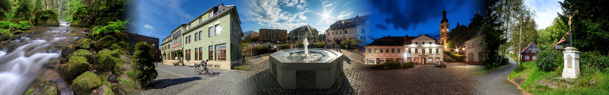

Bicycle Paths
Today there are around forty kilometers of bicycle pathway in the region of Šluknovský promontory. They lead along public and forest roads, which have an appropriate technical state. In some parts, those trails are used for hiking, so be careful; the pedestrian always has the right of way. The network of cycleways is connected to an already existing network of trails, including those that are outside of the national park area. Just as with the touristic pathways, the bicycle paths will lead the visitors to interesting places of České Švýcarsko.
211
Rožany - Šluknov - Staré Křečany - Krásná Lípa - Rybniště - Chřibská - Kytlice
The entire cycle way is 46 kilometers long. There are a few hills on the way, although they are not difficult to pedal up. The cycleway leads us from the state border crossing at Rožany-Sohland through a forested nature trail, further through Šluknov and Old Křečany towards Krásná Lípa. The trail is a little bit more challenging around Old Křečany, but only for a short time. On Skřivánek it crosses with route #3014. Then, it passes through Krásná Lípa along the Informational Center and intersects with the trail #3013, continuing over Vápený Vrch and leading to Rybniště and Chřibská. Here we can find the oldest glassworks in Europe that is still functional. You will pass it on your right side. Then you will turn right and go through the Krásné Pole, continuing to Kytlice.
3029
Vysoká Lípa - Šaunštejn - Tokání - Chřibský hrádek - Doubice - Kyjov - Vlčí Hora
The whole trail is 17 kilometers long, and for the most part, it follows the borders of the national park. It is among the hilliest trails that are in this area, yet it leads us through countryside worth admiration. It starts in Krásná Lípa along the castle Šaunštejn. Under Ptačí Kámen it turns to Táborový Důl, by which you will get to Tokáň after making a bit of a climb. Here you can rest. The signs will then lead you to Chřibská Castle, to Doubice, and to Kyjov. You will pass turns for trails #3031 and #3032. Our goal is, however, the Vlčí Hora settlement, to which we will get after passing Dlouhý Důl, full of historical buildings. The cycleway ends here under the outlook.
3031
Doubice - Zadní Doubice
This cycleway is only nine kilometers long. Even though it is very short, it is among to the most challenging trails. It starts on the turn from Trail #3029 between Doubice and Kyjov. Firstly, the road is coated by tarmac but do not be confused. After only four kilometers it changes into a graveled, descending road, which can be dangerous. The trail stops at the end of the descent. On the state border crossing at Doubice – Hinterhermsdorf, one can see trail #3032, which enables us to continue in two directions.
3032
Kyjovské Valley - Zadní Doubice
This trail is nine and a half kilometers long and will show you the beauties of the Kyjovské Valley. It is one of the easier trails. The beginning is found in Kyjov, where trails #3013 and #3029 meets. It will guide you through the Kyjovské Valley up to Zadní Doubice. On the way, another trail, #3033, becomes attached to it. From Zadní Doubice the signs continue towards the villages of Kopec and Brtníky, where the trail finishes off and connects to Route #3014.
3033
This trail connects #3014 and #3032 and is three kilometers long.
3013
Jedlová - Malý Stožec -Chřibská - Horní Podluží - Studánka - Krásná Lípa - Kyjov
This trail is 21 kilometers. Altogether, it only has a slight elevation difference, and it meanders through the beautiful countryside. We set off from a train station in Jedlová together with the trail #3015, and it leads us along Malý Stožec to the train station Chřibská. Before the trail reaches it though, it turns to the right, leading us under the hill Žulovec, to Horní Podluží. Intersecting at Horní Podluží, it continues towards a unique windmill that is unparalleled in Czechia because it has five arms. Through the village Studánka, the path leads us to the Křinice springs and further to Krásná Lípa, where it meets with trail #211. From here only a few kilometers remain to the peaceful village of Kyjov, where the trail ends. Here it connects to two other trails, #3029 and #3032.
3014
Dolní Poustevna - Vilémov - Mikulášovice - Tanečnice - Brtníky - Mikulášovice - Vlčí Hora - Zahrady - Dymník - Rumburk
The entirety of this trail measures 30 kilometers. It leads us from one border crossing to another, and from one outlook to another. It is not very demanding and follows a superb road, and is sometimes just little bit hilly. The beginning can be found at the border crossing of Dolní Poustevna – Sebnitz, along with trail #3043. You can also get on the path from the local train station. It goes further across Vilémov and Mikulášice, where it crosses with #3041. On the right side, you will be able to see a stunning outlook on Tanečnice, which you can reach by biking up to it. The markings, however, continue further to Brtníky and Vlčí Hora and one by one meet with trails #3032, #3033, and #3029. This part is a little bit harder, but the reward is the view from the outlook on Vlčí Hora, which stands along the trail. Then it continues to Zahrady, where the markings leave the asphalt road and follow a rougher path through the pastures. After a while, it meets with trail #211 and leads us further to another outlook of the region, Dymník, following a very pleasant road in the forest. In Rumburk it ends on the border crossing of Rumburk – Seifhennersdorf. Before you reach the end, do not forget to visit the local Loretánská Chapel, where you can also find an information center.
3015
Varnsdorf - Dolní Podluží - Jiřetín pod Jedlovou - Kytlice
This path measures 17 kilometers. It starts at the border crossing between Varnsdorf – Seifhennersdorf and leads across the town towards Dolní Podluží to Jiřetín pod Jedlovou. Here you can find a lot of interesting stops. Here, we can see the gallery of the Evangelist Purkyně, an information center, a mining museum, and the way of the cross to Křížová Hora. The signs continue to the ruins of Castle Tolštejn, and from there you can go to the close-by lookout Jedlová. The trail continues along the Tolštejnská road to the train station at Jedlová and further to Kytlice.
3041
Lipová - Velký Šenov - Mikulášovice
This path is 16 kilometers and has two final destinations, two ends. The quality of the roads is very high; the way is often varied with a small hill. It starts on the border crossing at Lipová – Neugersdorf and meanders through the village of Lipová to Velký Šenov. It continues to Mikulášovice, where it crosses with trail #3014 and the trail forks. In one direction, it goes along the lookout Mikulášovice to the border crossing of Mikulášovice – Sebnitz, and in the other direction to the border crossing at Mikulášovice - Hinterhermsdorf, along Hraniční Vrch.
3042
Šluknov - Království - Rumburk - Jiříkov
This trail is 17 kilometers long and follows descending roads. It is suitable for a Sunday cyclist. The beginning is found in Šluknov, where two other, older trails, #3043 and #211, meet. The road continues to Království and then follows a very easy path to the restaurant Zámeček. From here, a nice descent awaits you, leading to the center of Rumburk, where one can rest for a while. It is only three kilometers to the end of the bicycle path. What is the destination? It is the border crossing at Jiříkov – Neugersdorf, where the last trail, #3043, begins.
3043
Jiříkov - Šluknov - Staré Hraběcí - Lipová - Severní - Lobendava - Dolní Poustevna
This path the longest, with a total of 34 kilometers, and it runs from one crossing to another. The quality of the roads is appropriate. It begins on the border crossing at Jiříkov – Neugersdorf. The cycleway then leads you through Jiříkov, where there is another border crossing, Jiříkov – Ebersbach. The more challenging parts arise towards the town of Šluknov. Here the trail crosses with #211 and #3042 and then continues to Stará Hraběcí and the border crossing Lipová – Sohland, where it meets trail #3041. The trail then continues across the settlement of Liščí to the village Severní. Here you can go on up to the Severní - Steinigtwolmsdorf border crossing or you can go to the village Lobendava. There is another border crossing at Lobendava – Langburkersdorf that you can take, but you can also continue to Dolní Poustevna. Here the two trails become one, and it all ends at the last border crossing.