Čeština
 Deutsch
 English

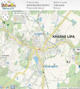
The Surroundings of Krásná Lípa


Interesting Touristic Destinations in the Surroundings of Krásná Lípa
(The distances from the center of Krásná Lípa are in parentheses)
JESKYNĚ VÍL The Cave of Fairies (7 km to the west)
The overhanging cliff and underground rooms can be found on the hillside on the right bank of the Křinice in the Kyjovské Valley. In the good conditions at winter, we can observe ice formations.


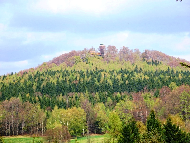
KAMENNÁ HORKA Stone Hill 499 m a. s. l. (2 km to the southwest)
It is part of Krásná Lípa. There is a beautiful outlook on Krásná Lípa with a rest area and an observation tower (2000). In the forest, there is basalt mine that is 516 m a. s. l.

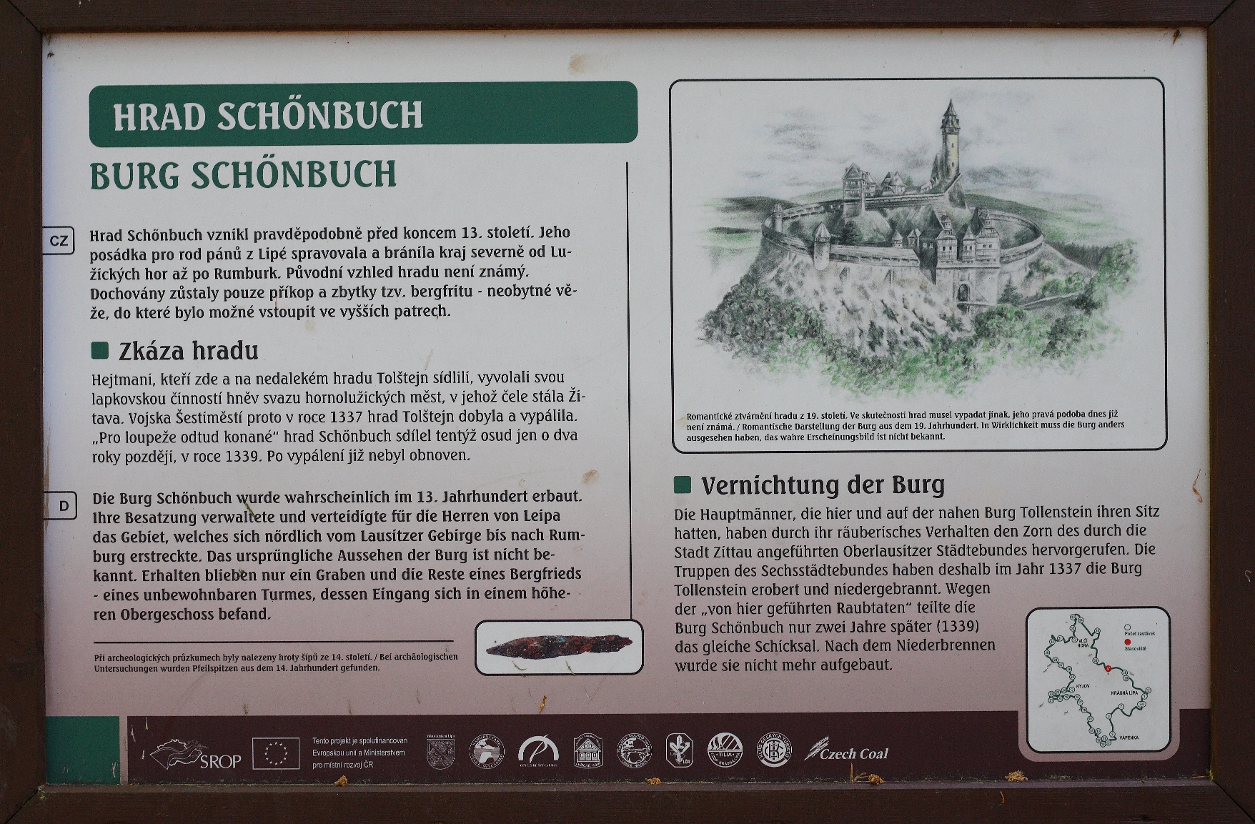
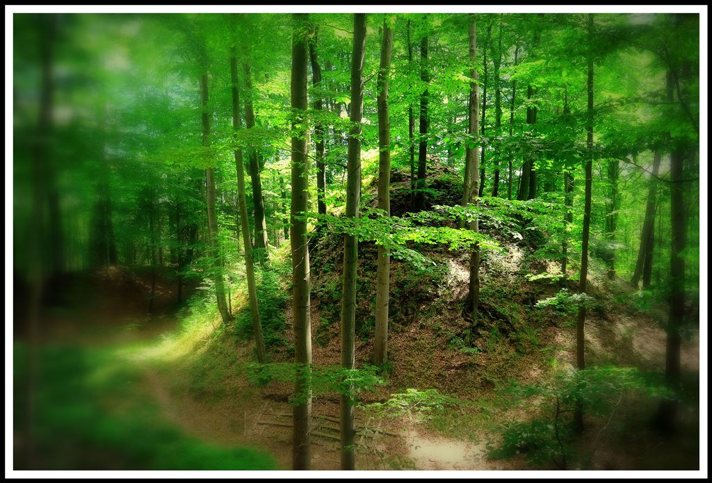
KRÁSNÝ BUK Beautiful Beechwood, the ruins of a castle from the 13th century (3 km northwest)
In 1319, Jindřich from Lipé traded Krásný Buk with Jan Lucemburský. Right after, however, It was sold into the ownership of the Vartenberks. Their retributive aggression towards the group of six cities in the area led to the fall of the castle. The access road went from the north tableland through some banks up to a hill where there was a wooden castle with a tower. The brick foundations are still there. On the spot of today's tourism signpost, a beech tree was planted at the occasion of the Emperor Joseph the Second's coronation.
SPRINGS OF THE KŘINICE (2 km to the west)
The Křinice springs in Přední forest between Studánka and Krásná Lípa. The adjusted springs were officially presented to the public on Sunday the 20th of October, 1907. The Czech Tourism Club in Krásná Lípa reconstructed its marked trail. On Monday the 30th of April, 1990, after some hard work, the springs were again presented to the public.


THE KŘINICE RIVER (0 – 15km to the west)
It springs up west of Studánka, deep in the hilly area of Šluknov. Its stream mostly flows in a northwest direction and it is 17.3 km long. Out of that, the canyon in Jeřiichoviské walls is about 12 km long. The river basin is, all together, 34.5 kilometers long. About eight kilometers help to create the border between Czechia and Germany. After leaving Czechia, the river flows as the “Kirnitsch” through Saské Švýcarsko, and then it flows into Elbe in BadSchandau.


KYJOV, 26 inhabitants (5 km to the west)
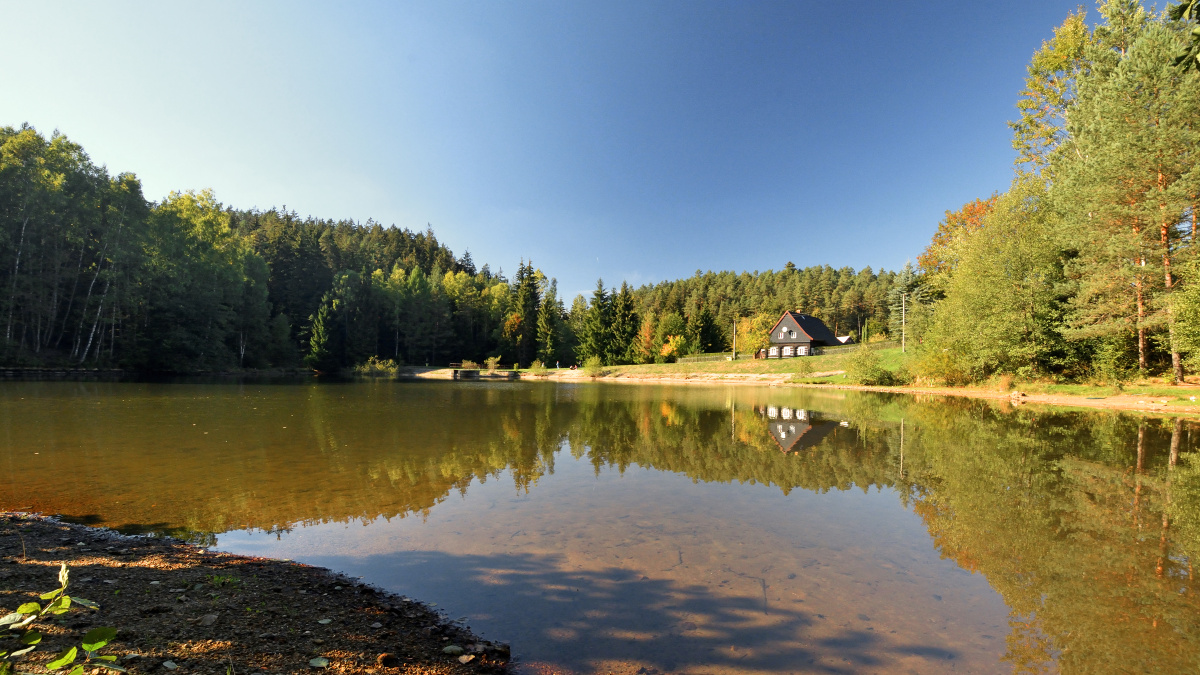
Kyjov is an oblong (346 m) village along the Křinice. The meaning of Kyjov is associated either with the cattle pasture or shelter, “kavna,” which were used while mining. Between Kyjov and Dlouhý Důl, there is a line to the Lužický fault, the border between the sandstone blocks and granite. In 1844, a group of people had set up a Mountain Society that tried to make all the interesting geological places accessible. In the village, we can observe the old, woody, historic houses, and it is also possible to swim in the small dam.
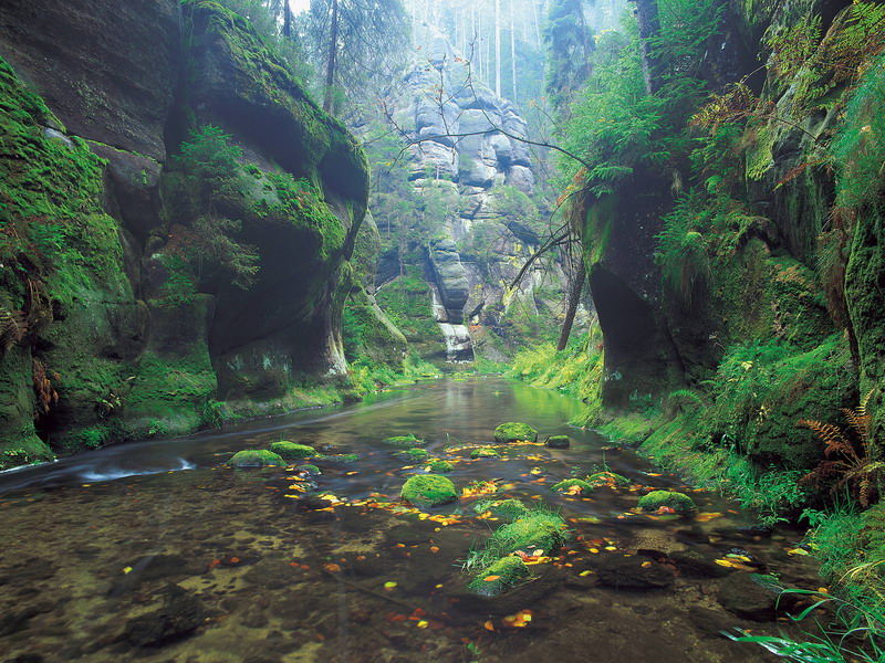
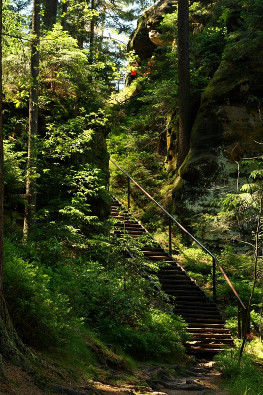
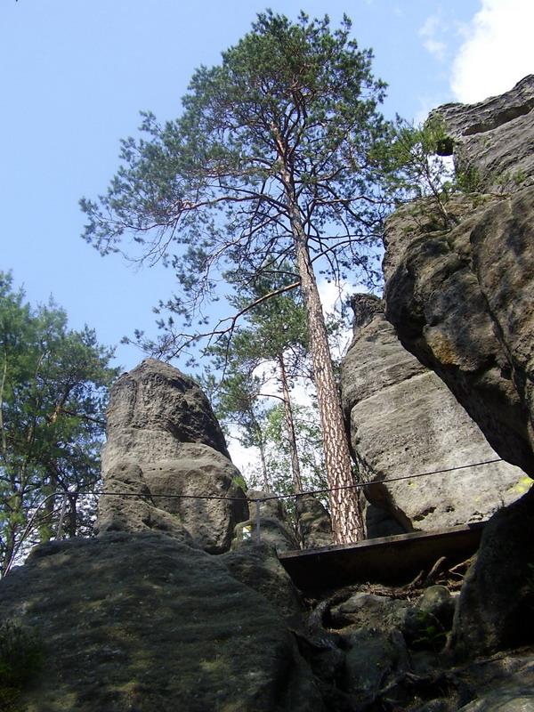
KYJOVSKÉ VALLEY (5-15 km to the west)
This valley is part of the Křinice canyon in chalk sandstone. It starts in Kyjov and continues to the west, up to the bridge at the mouth of Bílý Potok and Brtnický Potok. The presence of three small medieval castles indicates that once trade roads used to lead here in the past. The Hohnstein Castle used to be part of Czechia, but now it belongs to Germany. The valley is the starting point for many ravines that show us the amazing geological formations and climbing walls.


KYJOVSKÝ CASTLE 385 m (7 km to the west)
It is sometimes also called Horní Karlštejn or Pstý Hrádek. Its ruins can be found one kilometer away from Kyjov if we follow the yellow trail. There are no written records, so we can only assume it was built somewhen in the second half of the 13th century. Its purpose was to guard and protect the Lužická trade path. It was also a safeguard for mining and industrial business in the area (the glassworks at Doubice). At the end of the 14th century, the castle and its former name both ceased to exist. The first written record from 1603 does not mention the original name.


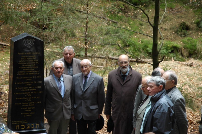
THE DEATH MARCH MEMORIAL (15 km to the west)
We can find it 100 meters away from the border crossing to Zadní Doubice. The original wooden monument was restored in 1998 and soon after destroyed. It was replaced by a stone obelisk, 2 meters high.


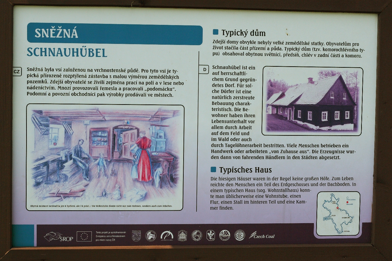
SNĚŽNÁ 22 inhabitants (4 km to the northwest)
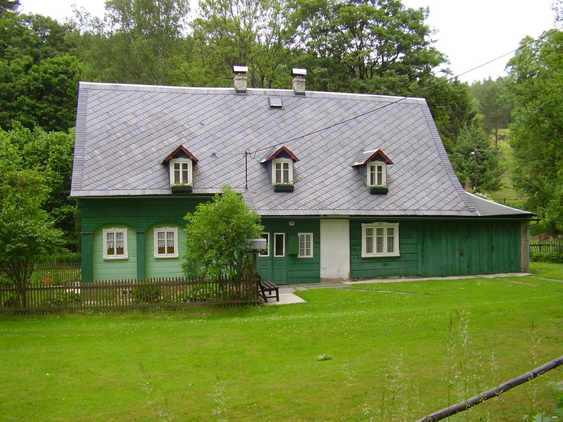
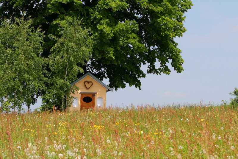
This village can be found on a tableland (490 m a. s. l.) It was set up during the Dominican colonization in the 17th century. Nowadays it is mostly used for recreation. Visible from far away, the baroque church of Saint Marie the Snowy used to be a place of pilgrimage; it was built in 1732 and furnished in the 19th century. Right on the road, there is a baroque chapel, and there are many wooden log houses around it from the 18th and 19th centuries.

TOURISTIC BRIDGE (10 km TO THE WEST)
It is a bridge over the Křinice close above the mouth of Vlčí Potok. It is an orientation point in the lower part of Kyjovské Valley. The name was already in use at the end of the previous century. The green trail leads to it.


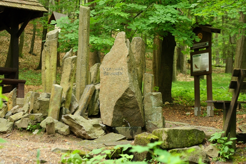
VERONIKA SPRING (5 km to the northwest)
Beneath the view tower on Vlčí Hora, there is a spring with excellent, potable water, which was built in 1886. There were some benches placed about for resting. The Tourism Club in Krasná Lípa reconstructed the whole place in 1996.
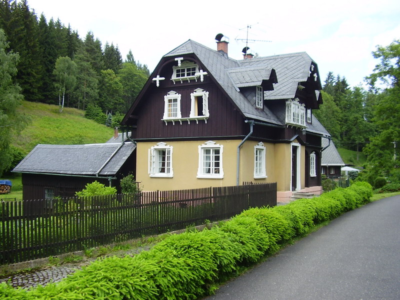
VLČÍ HORA Wolf Mountain, the village, 476 m a. s. l. (5 km to the northwest)
It is a very small village in the seat between Vlčí Hora and Kamenný Vrch. It was probably established in 1589 during the colonization of the deep forests. The church there is was built in 1870. There is a story of a thief and arsonist and his wife. The thief was so good at escaping that people started to believe that his red vest was magical and enabled him to be invisible. After cruelly murdering an old craftsman, he was caught with a trick and later, in 1740, hanged in Lipová. It was the last execution in the area. The village is well accessible by train, and there is also the possibility of accommodation and food.


VLČÍ HORA 581 m a. s. l. (7 km to the northwest)
It is an oblong, forested hill, where on the peak there are basalt formations, sometimes with columnar degradation. The columns also consist of magnetite that can confuse a compass needle. In the mature forest, there are many rare and valuable plants. On the peak, there is also a 19 meter-high view tower that was built in 1889. The cottage next to it was built in 1887. The observation tower's hours of operation can be seen on The Tourism Club’s notice board on the square, in restaurants in the area of Vlčí Hora, or online at www. mujweb.cz/www/kct_kl. The tower has a 360° view, and on the hill path is Veronika Well.


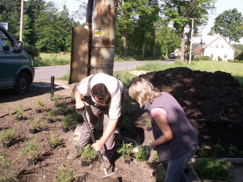
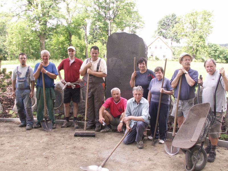
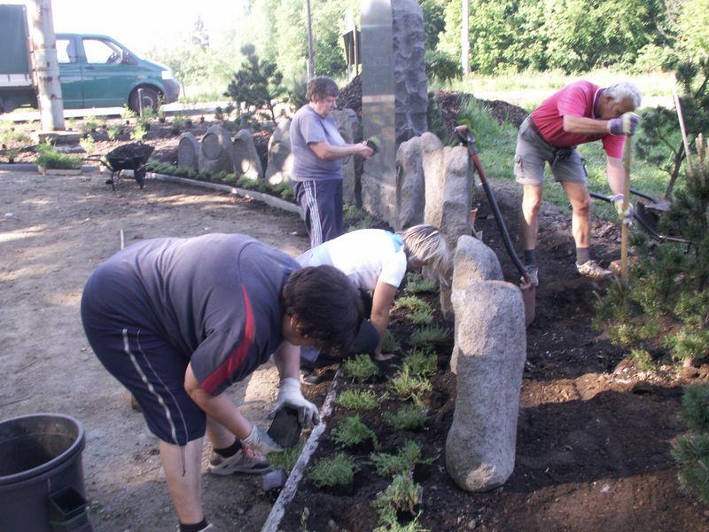
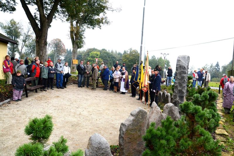
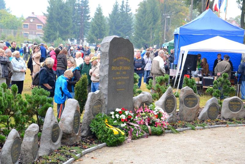
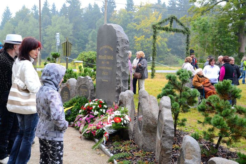
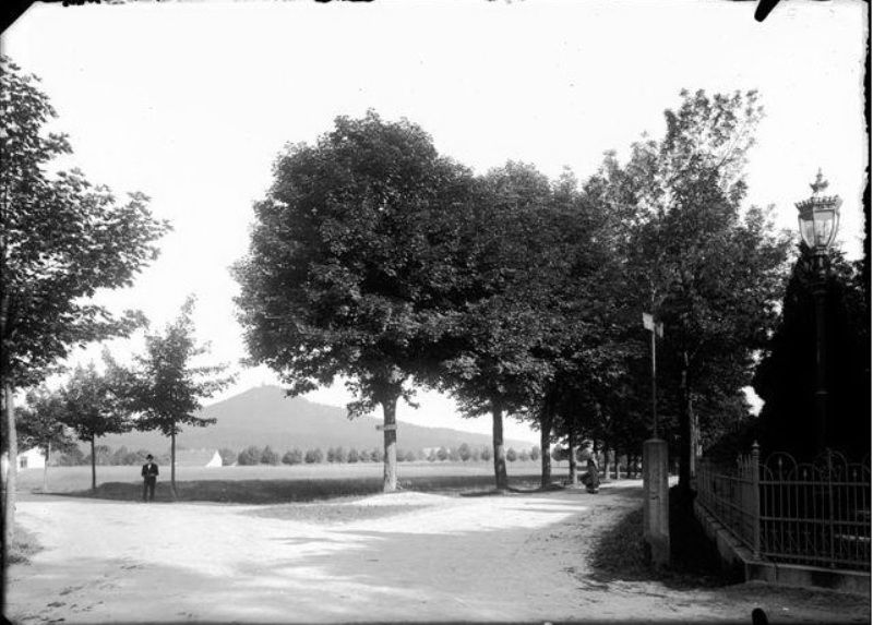
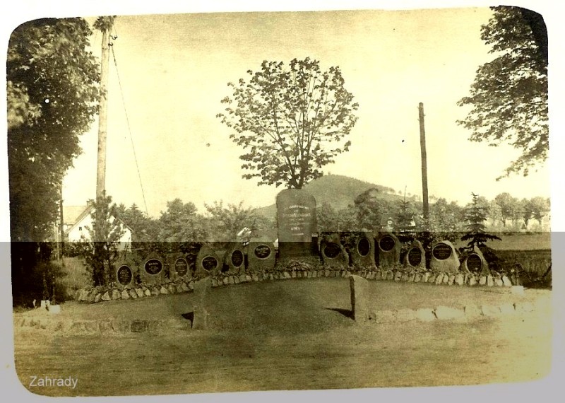
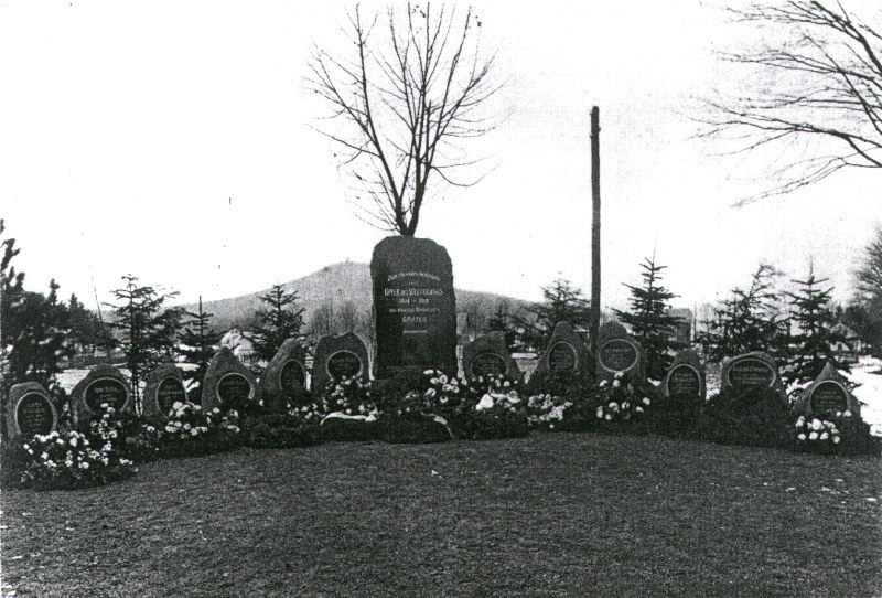
Memorial to the Fallen Inhabitants of Zahrady during The First Word War
The memorial in Zahrady used to be at a different location than today. It was first unveiled in 1922. It was renewed, thanks to the activity of some local people and The Czech Tourism Club members, in cooperation with the town of Krásná Lípa. They returned the headstones that had been deposited in the graveyard in Sněžná. The site itself has lived to see the alterations to its orchards according to the project of Ing. Karel Hieke. The pictures below document the history, the renovation, and the reopening on the 22nd of September, 2012.
BRTNICKÉ ICEFALLS (10 km TO THE WEST)
They can be found mostly in the area of Malý and Velký Potok, Štenberk, and Brtníky.
VLČÍ TABULE Wolf Tableland (17km to the west)
We can walk there following the blue trail between Zadní Doubice and Tokáň. The sign claims that the gamekeeper Grohmann shot two wolves here in 1640. The sign was renewed after some damage.
ŠIROKÝ VRCH (Karlova Výšina) 586 m a. s. l. (5 km to southwest)
It is a restored touristic outlook from 1997.
VAPENNÝ VRCH Lime Hill 548 m a. s. l. (2 km to southwest)
It is mostly granite and forested hill, where there is the only state nature reservation in the Šlukov area called Vápenka.
VÁPENKA Limeworks (2 km to southwest)
It is a state nature reservation covering 15 hectares near the Lužický fault: Three very different rocks meet here: granite, Jurassic limestone (unique to Czechia), and sandstone. All of that is interrupted by Tertiary basalt volcanism. In a unique grouping, all of these geological elements create the area of Northern Bohemia. The varied geological foundation enabled the creation of fertile ground for rich vegetation. In the secondary spruce forest, the beech trees were preserved, along with maple, sycamore maple, lime trees, pine trees and ash trees. On the forest floor, there are, for example, February Daphne, broad-leaved helleborine, lily of the valley, Red helleborine, early-purple orchid, Twayblade, or deer fern.
BIG PRUSSIAN CAMP (10 km to the west)
This is a massive rock cliff is south from Štenberg, and it used to be a refuge place for the local people during the Thirty Year’s War. It was crucial, especially during the Seven Years War, when the Prussian soldiers marched through the region, but also during the Austro-Prussian War in 1866.
VLČÍ HRÁDEK Wolf Castle (9 km to the west)
Also called the Prussian castle, it no longer stands, but we can still see its ruins. It is one kilometer from the Touristic Bridge and two kilometers away from Vlčí Hora. There are no records about the castle, and we can only guess that it was one of the supporting points during colonization of the thick forests. It served the lords to protect trade roads. Before becoming part of the Germany in 1443, it lost its function and probably ceased to exist.
VLČÍ POTOK Wolf Stream (10 km TO THE NORTHWEST)
It springs from the foothill of Vlčí Hora, close to the train station at Panský and flows into the Křinice from the right bank at the Tourist Bridge after about 8 kilometers.
WINE CELLAR (6 km to the west)
It is a cave in sandstone rocks on the left bank of the Kiřinice in the Kyjovské Valley. In the winter the shape of icy formations reminds one of wine bottles.
BÍLÝ POTOK (15 km to the west)
Its fountainhead is at the train station “Mikulášovice horní nádraží.” It creates part of the state border, and in the late Zadní Doubice, on the right bank, it flows into the Křinice. The streambed has an interesting composition.
BRTNICKÝ CASTLE (15 km to the northwest)
It is the smallest castle in this area. Its ruins can be found on the sandstone promontory that dominates the deep mine. Its origins date back to the 13th century, and it helped develop the dominion of Berkové from Dubá. It probably also protected the connecting routes from Lane to Lužnice. Without any records, we do not know the original name.
BRTNICKÝ BROOK (12 km to the west)
It flows into the Křinice on the right bank, close to the state border at the Tourist Bridge. The springs can be found beneath Ptačí Vrch to the northwest of Brtníky.
ČERNÁ BRÁNA The Black Gate (15 km southwest)
This natural formation stands in the Hřebcům mine at the Jeřichovické walls. The collapsed block of rock created a natural arch 3 meters high, and 5 meters wide. The Červený brook flows through it. Three hundred meters away, the Křinice traces the state border.
DYMNÍK (5km to the north)
The forested, basalt hill stands about two kilometers southwest from Rumburk. It is a pleasant walk up, and on the peak is stone view tower that stands 15 meters high. It has been open since 1896 and is still freely accessible. There is also a restaurant close to the peak.
HAMLET DOUBICE, 77 inhabitants (5km to the southwest)
This place is very suitable for recreation and completely protected by thick forests. Nová Doubice merges with the old Slavic hamlet. It was established with the plot of a homestead in the 18th century. There is a record from 1457 about one of the first glasswork movements in Czechia. There is a Classical church of Saint Mary’s Assumption from the years 1811 to 1814. The former presbytery building was built in 1814 in a style typical for this region. In the territory of the village, there is the hill Spravedlnost (Justice). To the northeast, we can walk to Vápenný Vrch, where a view tower was built in 1998.
EUSTACE (10 km to the southwest)
It functions as an orientation point, and it is one kilometer away from Bor and one kilometer away from Tokáň. The crossroads with a shooting lodge is named after the picture of Saint Eustace, who used to stay here.
BORDER CROSSING (15 km to the west)
It can be found in Zadní Doubice, and it is for tourists that are on foot. It was restored on 1 October 1996.
ON TOKÁŇ (10 km to the southwest)
This group of alpine log cabins lies to the northeast from Jeřichovice. A guardhouse used to stand as a refuge for gamekeepers. “1563” is written in one of the cages. There were several log cabins built for the owners of the domain and their quests for hunts. One of the guests was Lord Runciman. In the 19th century, they became a base for developing tourism. After a fire in 1905, the current log cabins were built. A reservoir was carved into the top of the block of rock to the south from the cabins. Today the cabins are used for recreation and in one of them, refreshments are offered.